Sunday, February 27, 2011

February 28 - Around Kaikoura

So, this is a spoiler alert!  If you don't want to get upset about us having a great time in paradise, don't read today's entry.  As I said yesterday, it's just another shztty day in paradise.


After a sleep-in (07:30) I got up and did a little touring along the waterfront.  I met this friend having a snooze out at the point. The NZ seals seem to be larger than our local variety.


This is the coastline out near the point.  One of the early European settlers here was a fellow named John Fyffe (circa 1860).  When he brought his wife out she asked "When are we getting to the town," he replied "You are driving through it, dear."  They stayed for 40 years.  Kaikoura was a whaling station for a while, although to me it doesn't look like much of a protected harbour.


Here's the old wharf near the point.  It's looking  pretty decrepit now, and is slated for redevelopment.  The wharf at the whaling station is "Use at your own risk" - it's getting pretty  unstable looking.


A view of downtown Kaikoura.  I'm on the railway bridge as it goes over the main street.  The business district is one street wide.  Lots of funky cafes and bars along the street.


And here's photographic proof that I went swimming while in NZ.  It wasn't particulary warm, and it was saltier than Georgia Strait.


Meet Cedric.  I took out a mortgage and cashed in an insurance policy so I could buy him.  He's a crayfish (no claws) and is the famous seafood dish here.  I bought him in one of the few fish shops we've seen, and had an interesting discussion about the various types of seafood there.  Remember the salmon farm I told you about - this fish store was selling their product.  I had salmon for dinner last night, but was slightly disappointed as the flesh seemed "mushier" than our salmon. 


Small world department:  Leddy and Jerry - guess who pulled into town?  Adventure South Bicycle Tours with a group of Danish cyclists.  Their guide is a Dane, taking them on a special tour called "Willie's Trip.".  Instead of staying one night and then going to Christchurch, they will be staying 3 nights.  Their guide was busy organizing things for them to do.
Note - Adventure South runs escorted bicycle  tours, where the bus carries everybody's gear and the cyclists ride to a specified destination each day.


Today's humour corner is brought to you by www.wickedcampers.com.  They are a car rental company that rents small crazily painted vans.  These photos are of a couple I saw today in the town.  

Every time one passes us on the road I try to read the "words of wisdom" on the back end.  Some of the comments get pretty racy - I won't tell you the rudest I've seen.


Last photo - I saw this on the back of a great big garbage truck - I guess he was trying to calm down itchy drivers following him.


We're on the road again tomorrow, about 80 km to a biker's hostel called "Pedlar's Rest."  I'm watching the news on the TV right now - there's gale force headwinds going to happen later tomorrow.  They are predicting gusts of 90 km/hr Wednesday in Christchurch - those poor people just can't win.

We just came back from town after getting ice cream cones.  We spotted a contractor whose firm name was blazoned across the side of his van: "Well Hung Wallpaper Services."  These folks have a good sense of humour.


February 27 - Greta Valley to Kaikoura - 105 km

First, I'll apologize to everybody for this blog entry - you'll see why by the time you finished reading it.  How's the snow in BC?

The skies cleared overnight and we got a good start.  We are on highway #1, not too hilly and not a huge amount of traffic.  The shoulders range from wide to non-existent; unfortunately a lot of the edges have "rumble bumps," those annoying lumps of white paint that make your bike shudder.

 These first two photos are of the rolling hills early in the morning when the light is nicer.
Here's a contender for the world's smallest railway station.  
The road runs adjacent to the railway for much of our day, so the grades aren't too bad.


We pulled into Cheviot about 09:15 and had a huge second breakfast at the cafe there. Their baking goodies looked so good that I could have stayed there and devoured them all day. This picture is of the church adjacent the cafe - unusual as it is river rock & cement construction instead of masonry. The statue belongs to the cafe.


Further along I took this shot of a river bed from the bridge crossing it (railway bridge in the background).  This is typical of many of the river beds - very wide and gravelly with multiple river streams braiding their way along the bed.  I suspect when there is a lot of run-off the river fills its bed and becomes very impressive.


This one cracks me up.  This house is on its last legs - the roof is rusted and falling off, the paint is gone, the siding is worn.  But, check out the satellite TV dish!


We climbed a pass, but didn't realize it was a pass as it wasn't more than 200 meters high.  Coming down the other side we saw the ocean (I think for the first time since Milford Sound).  Note the heavy kelp close inshore.

The road snaked along the shore alongside the railway track, with numerous short railway tunnels in 
the narrow spots.  At one point there were 3 tunnels side by side - the railway and one for each lane of the highway (sorry, that photo didn't turn out).  And, another bonus, the winds stayed light; those nasty northeasters didn't materialize.


Closer to town the shoreline widened out and became predominently limestone.  One last hill and we came down into the seaside tourist mecca of Kaikoura.  The next photo is from the driveway of our motel looking north and the last is looking south.  See why I apologized (as you shovel)?


We're staying here for a day before we move on.  Have to play tourist, you know.  It looks like it is going to be another shztty day in paradise.


Quake update - Unfortunately no live recoveries since last week.  Fewer aftershocks, but they had a 4.1 (depth 5 km) aftershock which rattled people.  They are getting more power and water back to the affected parts of the city.

We watched an interview with a fellow from Adventure South Touring (Jerry & Ledddy's tour operator for their last trip?).  They are meeting tourists at CC airport and taking them out of town on their tours, so they are trying to operate as normally as possible.  He emphasized that it is only a small part of CC that has been badly affected and that the best thing tourists could do is come and support the NZ people and their economy by having a great vacation.  

So, if you know of anybody contemplating a trip here, encourage them to come.  It would be the best 
show of support for NZ that you could make.


Saturday, February 26, 2011

February 26 - Oxford to Greta Valley - 92 km


It's hard to get up after stayng in a luxury B&B - I'd better tone down the accommodations or Laura won't do any bicycling at all.  She thinks she could get used to this!

We had breakfast in the cafe (Salmon Benedict!) and Laura got her doggie fix with Tosh (the manager told me they intended to have two dogs - Mac 'n Tosh.)

It was drizzzling just enough to convince us to don full raingear when we left.  Luckily, the drizzle disappeared a bit later and it was mostly dry peddling wihtout sun.  We headed toward Rangiora and noticed a number of helicopter flights overhead.  It turns out that they are ferrying hot food from volunteer kitchens into Christchurch.  A one hour drive is replaced by a 10 minute flight so the food stays warm.


A bit later I noticed my handlebars were loose (in the up & down direction, not the steering).  When we entered Rangiora I stopped to tighten up the headset bracket and found out it was cracked and broken!  I stared at it while Laura tripped into the library to hopefully locate a bike shop.  Out came Laura with a fellow who personally escorted us to the local bike shop, hidden behind a mall.  He works in Rangiora but lives in Christchurch - for the forseeable future he's moved back in with his parents in Rangiora as his place is in ruins.

So, another example of Kiwi helpfulness.  10 mintues in the bike shop and my bike,is good as new with a replaced headset bracket.

While in the shop we met a Nova Scotian girl now living here and got the lowdown on a route out of Rangiora which avoided the highway for 20 kilometers or so.  I programmed the new information into FRED the GPS, who only grudgingly accepted it.


Off we went through the countryside.  Nice flat roads through farming country, with a lot of vineyards.  The clouds were low so no photos, except for this one.

We made great progress to Amberley, bought some food and Girl Guide Biscuits (quite different from the Canadian version). Then off on state highway #1 north 30 km to the Greta Valley holiday Camp.  According to the Laura rating system, it's only a bare 2 instead of the stunning 1 from yesterday.  Below is a view of one part of the campground.  The two caravans on the right are also for rent - except I'd bet those are a 3, if not a 4.  Unlike the past few days the campground isn't full, so we may be north of the Christchurch exodus.


On the topic of keeping score I should update you on the FRED verses Laura contest.  I had told you earlier that FRED found a great route to Methven, cutting off 13 km from Laura's route.  This turned out to be true, as well as another 3 km shortcut on the way to Oxford yesterday.  So, as of this morining it was FRED 2, Laura 0.  However, today FRED slipped up since he missed the Inland route and also tried to send us down a dirt road later.  So, it's now FRED 2, Laura 1.

We're continuing north tomorrow.  The sky is clearing, the route is not very hilly, so hopefully we can get to Kaikoura.  Unfortunately, clear skies usually mean northeasterly headwinds.

Thursday, February 24, 2011

February 25 - Methven to Oxford - 78 km

I must have upset the weather gods because it's raining again.  Not cold, but certainly wet.  We both actually slept reasonably well in our cute little Methven hovel and hit the road at 07:30.

Our target for the day was the Ashley Gorge Holiday Park, about 8 km out of Oxford (87 km total).  One advantage of holiday parks - they always have space for another tent if everything is full.

In spite of the rain, we made very good progress.  The roads were flat with minimum traffic, no wind and it wasn't cold, so we sloshed along quite nicely.  We crossed two river gorges (Rakaia and the Waimakariri) which were both pretty, however the camera didn't come out in the rain.

Our route today took us about 10 km from the surface epicentre of the Sepember 4 earthquake (under
a town called Darfield).  We stopped for a coffee near there (in Glentunnel) and had a nice chat with the owners.  The September quake shook all the merchandise off their shelves, but the structure (wood frame) wasn't damaged.

A morning highlight - a pickup stopped and the driver hopped out and asked us if we wanted a ride.   We were near Oxford, so we thanked her and continued cycling.

We blew into Oxford just before noon (almost 80 km in 4 hours!) and stopped at a cafe/cooking school for lunch. Talk about service - they immediately took our jackets and put them in a dryer and gave us a towel to rub ourselves down.

Laura noticed a B&B sign in the cafe and enquired about it.  They were fully booked due to the
quake but had just had a cancellation.  So we jumped at it and are in a wonderful B&B.  Heated floors, heated towel rack, huge room and big, comfy bed.  We totally lucked in.  Since I didn't take any scenery pictures today, here's a shot of the bed.  Definitely a number 1 on the Room Rating Scale.


Don't show the owners what we are doing with their heated towel rack!


I was out for a short walk and snapped a photo of the original Oxford Jail.  Cute.  They also had a 
set of stocks, but Laura wouldn't pose for the camera.


Tomorrow we will make our closest approach to Christchurch as we pass through Rangiora, and then we
turn north.  Hills and a river prevent us from taking any routes further inland.  We'll go as far as we can depending on weather (supposed to clear but become windy), our energy (should be good after tonight's rest) and the availability of accommodations.

Quake update - Unfortunately not too much good to report:  no victims found alive for the past two days, some looting happening (200 Aussie police in town now), idiots abound (trying to sneak into the closed areas), secondary effects starting to occur (due to bad water, infection, etc.).  They are starting to make progress on power and water, but it will be a while yet for many people.

A comment about Search & Rescue - Yes, I am trained in Search and Rescue, but not Urban SAR which
has additional requirements over wilderness SAR.  Even if I showed up to volunteer I wouldn't be accepted as I have no proof of qualifications, no equipment (volunteers have to show up with at least full personal safety gear), and they want specialists, especially those with sniffer dogs, listening gear or demolition type rescue equipment.  I would be treated as an untrained volunteer, of which they have many.

February 24 - Geraldine to Methven - 70 km

Well, maybe complaining works - I was whining and snivelling about the rain yesterday.  Today we woke up to a cloudless sky.  But it was chilly.  OK, it wasn't snowing (sorry Pat & Ben) but this is summer - we aren't supposed to see our breath!


Once we got going the bicycling was great.  70 km of almost no traffic on pancake flat roads.  We made excellent progress.  First picture is of a church in Methven in the mornig sun.


We cycled along to Mayfield and took a break.  Mayfield wins the silly sign award today.  The "welcome' sign describes the size of the place ("Blink and you will miss it").  The coffee shop offers "Orgasmic Ice Cream" in the flavours listed.  We had a Cappucino.

I missed a sign on the way into town:  "Mayfield - Home of the World Famous Racing Pigs."  Another something to look up on the Internet.


This is farming country.  Sheep, cattle adn various crops (mostly winter feed for livestock?) are grown.  There are extensive irrigation systems installed.  We saw a lot of irrigation channels.  We are on the Inland Scenic Route.  On the one side are beautiful fields with hills in the background.


Look the other way and we have - Manitoba!  Flat like a pancake.


 So, we are in Methven, in a "Holiday Park."  We've developed the following accommodation rating system:
1 - It's all good.  Clean sheets and comfortable beds.
2 - Hmmm.  Not so great, but what the heck, it's only one night
3 - We're getting skanky.  Better use our own sleeping bags.
4 - Really skanky.  Set up the tent in the room.
5 - Forget about the room - set up the tent in the woods.

This is a picture of our little abode for the evening.


Here is Laura's rating.  And that's generous.

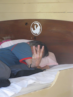
Maybe she was trying to tell me something else with her fingers.


Quake update.  When we biked into Methven we were surprised to see an "Earthquake Victim Reception  Site" set up.  We are now being affected by the quake insofar as there are almost no accommodations available.  Tourists have been shopped out of Christchurch to the surrounding areas, filling up everything available, including the homes of volunteers who have space.  We'll have problems finding accommodation for a couple more days, probably until we are north of Kaikoura.  This is as far away from Christchurch as we can travel, as we are are hemmed in by the mountains.  

Our plan is to continue north, biking to Picton, catch the ferry to Wellington and flying back to Auckland.  Biking to Christchurch airport is an option (Air NZ is flying people out of CC for $50 to anywhere else in NZ), but we rejected it because we have time and we have options (ie. we can tent).  Also, I doubt they would want to take our bikes.


Tuesday, February 22, 2011

February 23 - Fairlee to Geraldine - 46 km

3Another short day - we're getting to be wimps.  The plan two days ago was to go from Lake Tekapo to Geraline all in one day.  Yesterday it was winds, then rain.  Today it was straight drizzle.  We were both completely soaked by the time we got here.  I'm going to pay a little more attention to the art of staying dry tomorrow.  For the last few days the weather forecast has been optimistic and then let us down.  Oh well, if that's our biggest problem then we don't have any (especially when compared to the poor folks in Christchurch).

So, a nice easy ride through rolling countryside today.  Just out of Fairlee there was a viewpoint with one of those engraved plaques pointing out all the local mountains and features - at least where they are when you can see them!


Geraldine is a quaint little town.  I took a photo of an old hotel downtown.  Interestingly, the local bank (Westpac) is in a stone building of the same vintage as this, and they are closed today pending a structural evaluation due to yesterday's quake.  This hotel and bar - she's open for business!  Hmmm!

Geraldine owes its existence originally to timber and, no doubt sheep ranching after the timber was removed.  It is a pretty town, at least it would be in nicer weather.


This photo is of our backpackers.  It started life in the 30's as a maternity hospital.  Now it is a very comfortable and not too expensive backpackers.  The sheep belong to the residence next door.


Since there's not too much to talk about today, I might as well speak about F.R.E.D. (or FRED).  FRED is Laura's nickname for my GPS.  FRED stands for F... Ridiculous Electronic Device and I'll let you guess the first word.  Before we left for NZ I was able to download street maps of all of NZ (free!).  These included locations of all cities, hotels, restaurants, bars, etc.  So all I have to do is pick out a location in a town we're heading for and FRED plots us a course there.  

Laura thinks FRED has lead us astray a couple of times, hence the uncomlimentary name.  However, FRED has a great chance to prove himself tomorrow.  We are heading for the town of Methven.  Laura checked the maps and found that we have to go 80 km.  FRED looked at this and found a route along a secondary road that is only 69 km!  So, Laura has promised to apologize to FRED if this shorter route pans out.

Stay tuned!


February 22 - Lake Tekapo to Fairlee - 43 km & Christchurch Update

A short day today.  When we got up we thought the weather had improved enough to head out, so off we went.  Just out of town we hit headwinds, which lasted for about 20 km until we got to the top of Burke's Pass.  Burke's was a non-event because, at 709 meters, it is only slightly higher than Lake Tepako.  The general landscape was scrubby grass and low brush with a few trees.

The downhill from Burke's to Fairlee was a nice ride with no wind but by now steady rain.  We arrived at Fairlee and decided we had enough, so we grabbed a room.

We were just getting settled in when we felt the Christchurch quake, about 150 km away.  It was strong enough to be noticable and to swing all the clothes that were on hangers.  Laura felt one of the aftershocks later but I was out on my bike and didn't notice it.


I got out for a look around town, and took a few photos.  The first is James MacKenzie and (more importantly) his Collie dog.  Also, a shot of the main street.

These last two photos were taken at the local museum.  The first is a gyrocopter - the top rotor is free wheeling - it gets its lift from the forward motion provided from the propeller.  Anybody want to ride in this contraption?  the other photo is a well restored wagon.  The museum also had  a restored "night cart" with an explanation of what it did (before sewers were installed - enough said).


Our plans are in a bit of limbo with the earthquake.  Its obvious that the best we can do to help is stay away.  We will be going to Geraldine tomorrow and then possibly north, but skirting Christchurch.  Luckily, we have enough time to be flexible. 

February 23 - Earthquake + 26 hours.  We're in Geraldine now, 46 km from Fairlee towards Christchurch, after a wet morning ride.  Although things are a mess downtown, I think Christchurch will be stabilized in a few days.  Their biggest problems are:  Water (80% of CC without), sewer (public pleas to not flush toilets) and power (a lot is out - this is where underground power distribution is a disadvantage).  The airport is operating and will certainly be busy for a while as they catch up.  

We are heading to Methven tomorrow, following an inland route that will eventually take us near Darfield (the site of the September 4 quake), but 40 km or more from the epicenter of yesterday's quake.  I think we will be far enough away to not be a problem - if we are we will move further away, but are constrained by mountains.  We may or may not eventually get a flight our of Christchurch (or peddle to Picton and fly out of Wellington).

A big thanks to everybody who is watching out and being concerned for us.     


Monday, February 21, 2011

February 22 - We're in Fairlee

Hi:
Just a quick post to tell you that we are in a small town called Fairlee, about 150 km southeast of Christchurch.

There was another earthquake in Christchurch about 12:50 our time.  We were in a motel unit in Fairlee when we felt the quake here, but there was no damage in this area.

We understand that this quake, although smaller than the September 4, 2010 quake, has probably caused more damage as it was much closer to central Christchurch and much shallower.

At this point we don't know what we are doing.  We will be going to a town called Geraldine tomorrow, which is closer to Christchurch (still over 100 km away).  Then we will have to decide which direction to head in.  We have enough time to bicycle to any number of airports on the south island, but we have to be sure that airplanes large enough to carry bicycles can fly out of them.  We'll keep you posted.

February 20 - Omarama to Lake Tekapo - 92 km

A bit of a lazy start from Omarama.  I thought you might like this sheep statue in the middle of  town (ie. the highway junction).  For those of you who got tired of one lane bridges (of which there are still many) I've switched to kitchy statues.


The first surprize of the day - a salmon farm!  We are almost as far from the ocean as you can be in NZ.  Being nosy, I stopped  for a quick chat.  They raise Chinook salmon, in fresh water in net pens.  The water is glacial run-off and is cold which apparently suits the fish.  I don't know how they have become accustomed to living their entire life in fresh water.  Anyway, the fish looked great and the price was $15.90/kg for a whole, cleaned fish, head on.  I think that is better than the price in BC.


A nice flat 30 km to a town called Twizel, where we had a second breakfast around 10 am.  It turned out to be a good idea as there was nothing between Twizel and Lake Tekapo.  A few kilometers out of  Twizel we ran into a British Couple cycling in the opposite direction, towards Queenstown.  After the usual chat about where are you from, how long have you been on the road, how many flats, etc they told us to expect strong headwinds for the rest of the ride.  Oh, well.  A note about cyclists - the standard trip in this part of the country is a week or so from Christchurch to Queenstown, possibly with rented gear.  We've passed a dozen or so on this route in the past couple of days, although these Brits were on 6 weeks in NZ following a couple of months in Asia.

We usually stop or at least look like we're stopping when we pass cyclists.  About a quarter will stop.  I'm guessing the reason others don't stop is that they don't speak English or they are just plain anti-social.  In general, bicyclists are not a rarity on the NZ roads so most locals pay us no attention.


Back to today's ride - we are going through the Waitaki region.  This is a very wide valley with a
number of lakes and rivers.  The headwaters for the rivers are actually the inland side of the coastal mountain ranges, where we were a couple of weeks ago (Franz Josef, Fox).  The big feature of this area is hydro installations. There are 8 hydro stations on a chain of lakes (man made and natural) joined with 50 km of canals.  So, water entering the first lake on the chain (Lake Tekapo) will flow through 7 lakes, 4 canals and the 8 hydro stations on its way to the ocean.

We bicycled an alternate route to Lake Tekapo via one of the (private) canal roads.  Here's Laura after we went around a gate.  We turned onto this road through an open gate and were passed by a Meridian (hydro) vehicle whose driver was closing the gates.  He didn't stop to give us hell, so it couldn't have been a problem, except we had to man handle the bikes around the gate.


Oh yes, the headwinds - the British cyslists were correct, we got some good ones, especially on the
canal road.  We fought our way onward to Lake Tekapo and arrived a little chilly, as the elevation
of the town is about 720 meters.  Lake Tekapo is a samll town (350 residents) and who knows how
many tourists, as it seems to be another logical stop on the route between Christchurch and Queenstown.  Accommodations were scarce but we got a nice motel unit just back from the lake.
Here's the view from the unit.  The photo doesn't show it but there is a fierce wind blowing down the

lake.


A couple more photos of Lake Tekapo.  The first is a pretty little stone church on the lakefront.  And, a statue honouring the Collie dog, "..without the help of which the grazing of this mountain country would be impossible."  I like it better than the sheep.  What do you think, Tyce?


Onward tomorrow, maybe.  Its raining here now.  That may be good news as we were told that it is 
either very windy here or it rains.  A nice choice, eh?


Saturday, February 19, 2011

February 20 - Tarras to Omarama - 79 km


Another day, another pass to climb!  This time it is Lindis Pass at 965 meters.

First off, some golfing items for Pat and Ben.  The Tower Cottage (where we stayed last night) is right in the middle of the Tarras golf course.  On the way out we passed one of the greens.  Now why would the green be fenced off?  My best guess is that sheep can roam the fairways but I suppose you wouldn't want to have to putt around sheep dung so they keep them out.  If you hit a fence post
I would think you should get a free drop.  BTW, on the way into Omarama we passed their golf course - green fees were $15.


Onwards now, on a very nice morning.  Through the Cluden Valley, and nice valley scenery in the morning.  The picture with the moon in it is as we are climbing out of the Cluden Valley into the Lindis Valley (short climb, a hundred meters or so).


Now we are climbing towards Lindis Pass.  The area is dryer, with mostly sheep farms.  The climb is steady and steep near the top.


 Since we dragged our butts up this road we can show you the sign at the top.  And, of course, a photo from the top, looking in the direction we're travelling.  Quite stark landscape, and not as green as the valley floors.

Further along we entered the Ahuriri River valley, which opened way up, resulting in the wind dying.  Nothing spectacular about this valley - it's wide, flat and dry with the river roughly in the middle.  We made good progress on the last 20 km into Omarama.

Omarama is at the junction of highways 8 & 83 and I'm not sure what it owes its existance to.  Population 300, a few motels, one store, a gas station, and a holiday campground (where we are in a bed sized A-frame - cheap).  There are at least 5 other cyclists here, 3 Japanese and an Irish couple I just spoke to.  They are all going in the other direction, towards Queenstown.  For cyclists, Omarama is a logical stop before or after Lindis Pass.

Where is Omarama?   I've updated our South Island track - we are at the lower end heading  northeast.  We will probably be taking the inland route to Christchurch. 

Tomorrow's plan is Lake Tekapo, further northeast.