Hi - I won't be able to do along post today because of the computer I am on. I'll try to do something tomorrow. I write up the posts on our computer and then transfer them to a thumb drive, but this computer won't take any other inputs.
Anyway, we got back into the saddle today and made it to Waihi. There were a bunch of hills, but nothing terrible. The last downhill was a bit disappointing, because as soon as we started down, the headwinds were so strong we had to peddle downhill!
I'll have more stories and pictures next time I can sign on. Tomorrow, we are heading for Tauranga.
Greg
Sunday, January 23, 2011
Saturday, January 22, 2011
January 23 - Rain Delay - Tairua

So, here's Laura wandering down the main street. Except for the palm trees it could be BC!

 And this is the hostel we are staying in. No, its not the building, it's the little caravan under cover. It's a good thing it's under cover, because we think it leaks. In case you think we are in the lap of luxury, the TV doesn't work. Note how we carefully unpack and organize our gear.
Actually, the hostel is quite nice - the caravan was the only double room left when we showed up. Here is the view from the front deck. 10 minutes ago it was raining so hard we could not see the hill in the background.
I just checked the weather again - it has rained over 100 mm here today so far.
Friday, January 21, 2011
January 22 - Whitianga to Tairua - 53 km

Another short day, but the hills are getting smaller or maybe we're getting a little fitter, or
both. We left Whitianga by taking a short 3 minute ($5 including bikes) ferry ride across the bay
and climbing a hill (what's new). This headland is the next bay over. This area was visited by
Captain Cook during his voyages and he named some of the local features.

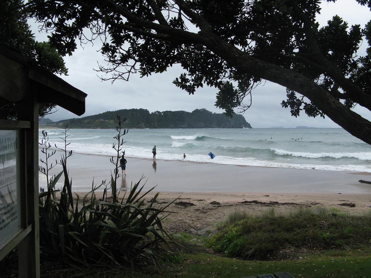
We made a side trip to Hot Water Beach. At low tide, hot (up to 170 deg. C) water seeps up
through cracks in the rock and heats up the water on the beach. Unfortunately, low tide was 4
hours away and the weather was closing in, so we left (I can take a warm shower at the hostel).
The two beach photos are of Surf Beach (next beach over) and of surfers at Hot Water Beach. The
hot water pools are just to the left of the furthest breaking wave.
The last photo is a grove of Kauri trees we passed.
We're staying at a hostel in Tairua tonight, and will decide in the morning if we should go anywhere. The weather forecast is pretty stinky, with rain (heavy at times) and the possibility of thunderstorms and 100 km winds. The weather improves in the following days.


The 3rd photo is a logging truck coming up the road loaded with Radiata (sp?) pine.
And the cute little shack is our room in Whitianga, at a hostel. Better than the dorm rooms. Click on the photos to get a larger view.
We're heading south today, stoppng at Hot Water Beach and taking a day off there if the weather holds (which it isn't predicted to).


Thursday, January 20, 2011
January 21 - Coromandel to Whitianga
Hi:
Just a short post today, as I'm on a pay station and there is a line up. Will try to do more later.
We made it over the killler hill from Coromandel today. (Yesterday some lady tried to scare the hell out of Laura and talk her out of doing it) We got a good start and made the hill early in the day, berfore it got hot. That didn't matter as it clouded over and is drizzling now.
Whitianga is a combination tourist trap and the vacation "cottage" country for Auckland's monied folks.
If i can get onto a computer later I'll put up some photos
Greg
Wednesday, January 19, 2011
January 20 - Thames to Coromandel - First Hills!

So, now we are into real NZ coastal roads, on a perfectly clear, warm day. Note the shoulders on much of the road. Pretty well non-existent with lots of logging trucks today. We traveled 54 km today, and hit our first real hills.

The 2nd photo is the last flat corner before the first hill, about 30 km into the day. Here is the view from the top of the hill (200 meters up).


And this is Laura booting it down the hills.
A highlight for me today was a ride on the Driver Creek small gauge railroad, north of Coromandel. Lots of photos (you'll love them, Al)
Tomorrow, we are crossing the penninsula to the east of Coromandel, towards Whitianga. There is one killer hill near the beginning of the day, so we're up early to avoid the noon sun. We'll see how far we make it.
Tuesday, January 18, 2011
January 19 - Pukekohe to Thames

If you look at the map I posted a few days ago, Thames is directly to the right of Pukekohe, just under the bottom left point of the W in Whangamata.
Tomorrow we will go straight up the coast, to approximately the highest road shown on that map (55 km).

The first photo is typical countryside as we got into the farming area. I didn't include my first picture of sheep (two of them looking at me as though I'm strange). We saw more cattle than sheep and even a deer farm.
This is my typical view on the road. The mountains in the background are part of tomorrow's trip.
 This photo is of the hills back of Thames, and I don't know what the light coloured trees are.
Thames is an old town, I believe dating back from the mid 1800's. It was established as a mining town.

A couple of examples of the buildings in town. The
 church is "New Zealand's Finest New Zealand example of wooden Gothic architecture. It is made of Kauri. The other building is a typical example of a building with the large verandas.
(Terri - I'm having trouble trying to get photos side by side. Can you figure it out? Also, thanks for the snack goodies you gave us for Christmas. We devoured them. Imagine - Skeet & Ike's in NZ!)
Subscribe to:
Posts (Atom)